Your Shopping Cart is empty.


Download sample
File Details
Published: 2018-02-07 12:31:47.507690 Category: Africa Type: Vector Model release: No
Share
       

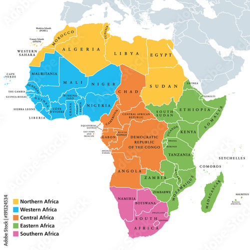
Africa regions political map with single countries. United Nations geoscheme. Northern, Western, Central, Eastern and Southern Africa in different colors. English labeling. Illustration. Vector.

Contributor: Peter Hermes Furian
ID : 191324534

TitleFilesize
Vector8033x8033


Buy on Adobe Stock

Keywords
africa, map, region, northern, western, southern, central, eastern, middle, southern africa, continent, political, country, name, single, land, colours, border, english, labeling, nation, division, classification, arrangement, madagascar, cartography, geography, travel, atlas, illustration, white, background, white background, vector