Your Shopping Cart is empty.


Download sample
File Details
Published: 2024-10-15 12:34:00.753339 Category: Travel Type: Illustration Model release: No
Share
       

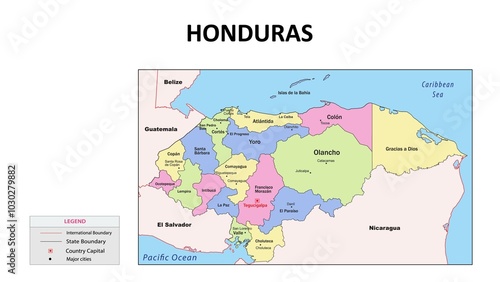
honduras Map. State and union territories of honduras with neighbouring countries. Political map of honduras with capital and important cities in Detailed.

Contributor: awesome artt
ID : 1030279882

TitleFilesize
Illustration3841x2161


Buy on Adobe Stock

Keywords
honduras, map, icon, vector, travel, isolated, infographic, line, flag, graphic, earth, tags, border, signs, drawing, modern, cartography, topography, politic, region, pin, pointer, circuit, outline, political, marker, county, country, subdivision, symbol, geography, large, border, continent, contour, detailed, geographic, international, land, nation, national, state