Your Shopping Cart is empty.


Download sample
File Details
Published: 2016-10-08 13:33:48.605327 Category: America Type: Vector Model release: No
Share
       

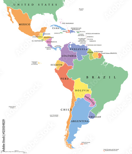
Latin America single states political map. Countries in different colors, with national borders and English country names. From Mexico to the southern tip of South America, including the Caribbean.

Contributor: Peter Hermes Furian
ID : 123034829

TitleFilesize
Vector7158x8333


Buy on Adobe Stock

Keywords
latin america, latin, america, map, state, single, country, nation, caribbean, mexico, south america, south, political, border, continent, brazil, colombia, venezuela, peru, argentine, central, america, galapagos, ecuador, chile, bolivia, atlas, cartography, geography, colours