Your Shopping Cart is empty.


Download sample
File Details
Published: 2021-01-24 15:54:19.284397 Category: Business Type: Illustration Model release: No
Share
       

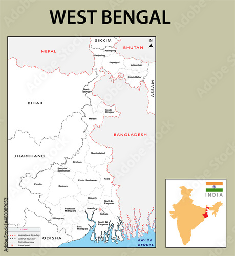
West Bengal map. West Bengal districts map with name labels. White background. Showing International and State boundary and district boundary of West Bengal. Vector Illustration of districts map.

Contributor: awesome artt
ID : 408089652

TitleFilesize
Illustration3148x3432


Buy on Adobe Stock

Keywords
abstract, administrative, area, art, background, banner, bengal, border, boundary, cartography, city, country, county, design, detailed, district, division, geography, graphic, grey, highlight, illustration, image, india, indian, isolated, kolkata, location, map, mapping, national, outline, place, political, poster, region, shape, state, symbol, territory, holiday maker, travel, vector, wallpaper, west